
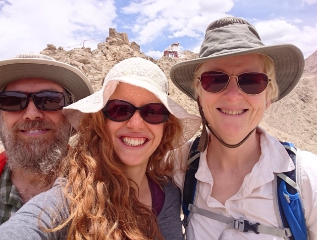
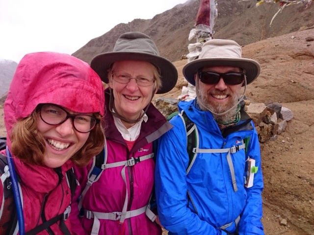
My parents joined me in Leh, Ladakh for just under three weeks, a little bit of home flying out to see me in the middle of my year of travels. They were secretly hoping to do the Marka Valley Trek, but were worried it would prove too much at their age and fitness level so we did the lower altitude Sham Valley Trek first (we refuse to call it the Baby Trek! Babies couldn’t not do it!) as a toe in the water to see how trekking at 3500 meters would go.
Starting out: Leh to Likir by bus
Doing the Sham Valley Trek with my parents started out badly. My dad had been up half the night with stomach troubles which persisted for half the Trek, and my mum had also had a bad night, woken by my dad and with worries of getting car sick on the hour and a half bus ride we’d do in the morning. I was feeling absolutely fine, just worried how things would go given the state of my parents.
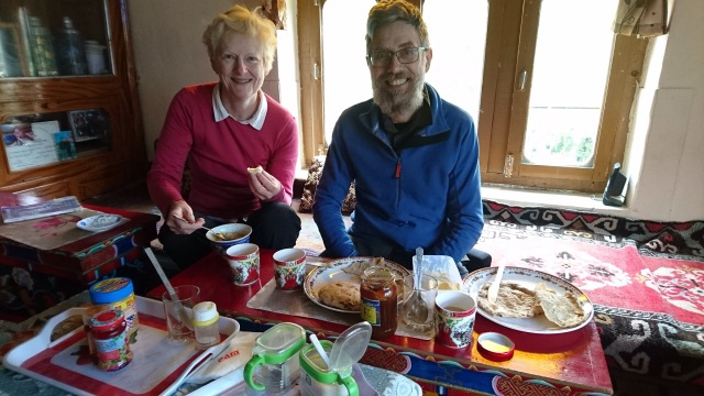
Undeterred we stumbled downstairs for the dismal breakfast the guesthouse provided – cold toast which we cheered up with some apricot preserve we brought the day before and a rubbery omelet which my mum forced down just slow enough not to bring it all back up again. She’s not a breakfast person. My dad went for a lie down.
I came to my senses about 5 minutes before we’d plan to set off and hurried everyone out the door before we actually missed our bus. We’d found out yesterday the daily mini bus to Likir, our starting point, set off at 8:30am so we walked the 40 minutes down to the bus station, pee’d behind the toilet (the actual cubicals were locked…we clearly weren’t the first to go al fresco) and got front row seats on the minibus.
Mummy’s worries about becoming car sick were thankfully misplaced and the hour and a half bus journey was spent watching Ladakhi woman cram into the front seats, joke around with the bus driver and generally spend half the time in fits of giggles. We managed to get off at the right stop, which was by no means obvious, by mentioning a guesthouse in the Charlie Loram book (see below) and were on our way! Daddy was still feeling reasonably sick, but otherwise all was good.
Day 1: Likir to Yangtang
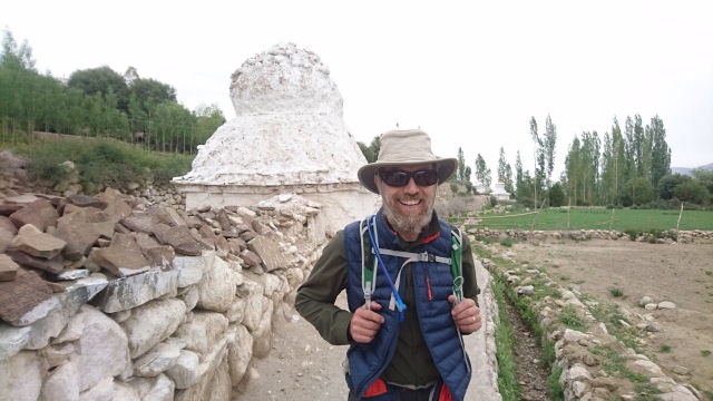
We were armed only with the Charlie Loram’s Trekking in Ladakh book, an 8 year out of date book which is still has the best map of the trek but the path was initially quite easy to find and we got on our way. We walked down a stoney path to the river and admired mani walls, low long walls with Buddhist mantras carved onto stones placed on top, and chortens, common Buddhist icons normally a few meters tall, for the first time.
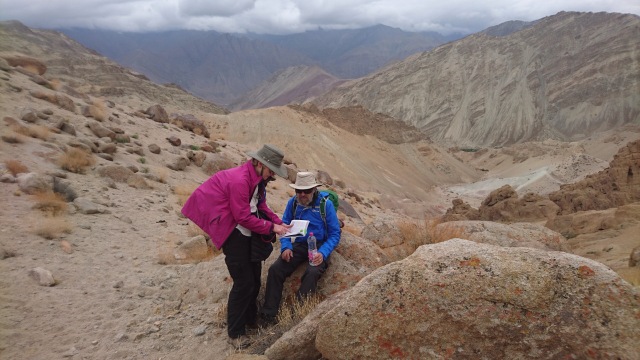
It wasn’t long before we lost our way though. Trying to navigate where you are from the roads marked on an out of date map when new roads are being built at a rate of knots turned out to be a bad strategy and we ended up walking up a not inconsiderable hill, especially considering the altitude, before realising we were half way to Saspotse, a village to the North of where we were going. After a quit rekky which revealed the way we were going would soon drop 100m down into a new Valley, not something we relished climbing back up again, I wisely turned on my maps.me, an offline mapping app, discovered our mistake and we made the executive decision to walk in the opposite direction and try and get back on the road we’d spurned half an hour before.
It turned out to be a good decision, but not without its consequences. We followed a dry river bed for a few carefree minutes and negotiated a few small waterfalls before coming to the top of fairly steep scree slope. Daddy, who seemed to get a burst of energy at this point, promptly started scrambling down it leaving me and Mummy no choice but to follow. Mummy entertained us with stories of scree running as a child in the Lake District and slowly slowly we all got down, edging our arses down the rock face.
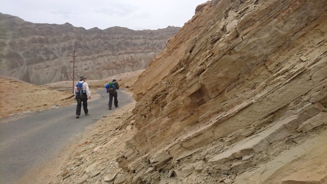
We spotted the road after a while, slid down on our arses a bit more and were there. Back on track! Such a relief. From there, with the help of maps.me, it was fairly plain sailing, although it did start to rain. We walked along the road until it met up with our actual path, crossed over a bridge and had a wet and miserable lunch underneath a tree. I was the only one who was eating properly at this point, both parents felt a bit sick. We set off from lunch the complete wrong way, following a couple who seemed to know what they were doing, but thanks to maps.me discovered our mistake promptly and turned back.
Then began the ascent which, especially for Daddy, seemed to go on forever. The rain was fairly light but unrelenting, I took Daddy’s backpack to lighten the load and he put on all his clothes to try and get warm. Slowly and breathlessly we made it to the top of Charatse La (3650m) and walked the rest of the way to Yangtang on the road, steadily getting more cold and tired.
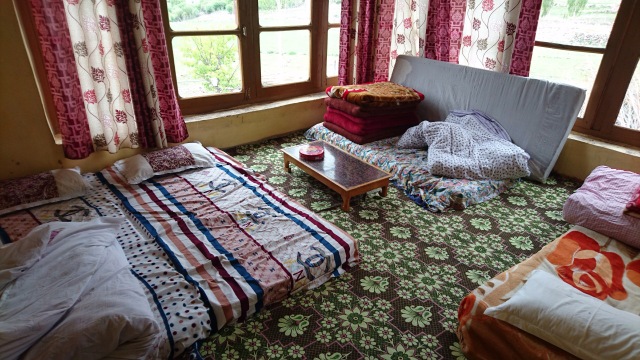
At Yangtang, we had no idea where the guesthouse we’d been recommended by the Ladakhi woman’s trekking company was but thankfully we found a kind man to point us in the direction, all the way to the bottom of the village near the steam. Guesthouses seems to have variable names so the name we’d been given ‘Tokpo Pa’ seemed to appear and disappear on the signs painted on rocks. We’d just decided we didn’t care which guesthouse we went to as long as we found one soon when we spotted a man tending to his fields who greeted us and showed us to none other than the ‘Tokpo Pa’ guesthouse. Amazing. We were shown to our room and given sugary milky tea to start to feel human again. I wore all my clothes and still felt cold until the delicious dinner of rice, lentils and greens.
We were the only people in the guesthouse, and had a nice time showing the couple pictures of our family we’d brought from home and seeing their pictures, before we went to bed around 9pm.
Day 2: Yangtang to Hemis Shukpachu
Day two started out well, no longer relying solely of Charlie Loram we got on the right road and climbed up the Sarmanchan La (3750m), even having time for a selfie. The rain had definitely set in and persisted all day, but Daddy was marginally better and we got a lovely ridge walk down into the village of Hemis.
We got an unexpected treat as one of the homestay hosts son’s, and a friend of his, were back from studying Geology in Shrinigar University and so we had a fascinating chat about the culture and future of Ladakh. He showed us some videos of them ploughing the fields with a Dzo (a cross between a Yak and a Cow) and wooden plough, shared that they had to plant their crops a few weeks late this year because there hadn’t been enough glacier melt and explaining about the innovative new technology of ‘artificial glaciers’.
One of the concerns about the future of Ladakh is that the young people now often go to university, but there isn’t one in Ladakh itself so they go to Shrinigar or Delhi and spend a few crucial years growing up away from their traditional culture, and then don’t necessarily want to come back to take over the farm when their finished. These guys were well aware of the problem though, and seemed keen to be a part of local Ladakhi life. They even mentioned a new proto-university that was being set up in Ladakh called HIAL, the Himalayan Institute of Alternative Learning, which amongst other things does research into artificial glaciers.
They also showed us an extract of a film about educating the Puga nomadic tribe in Ladakh which we all felt slightly awkward about. I’m essentially 100% for education and wish that everyone who wanted could have access to the same level of education I’ve received, but seeing these tiny nomadic children being pulled out of their ancient lifestyle to live in dormitories away from their families and traditions seemed wrong. Equally seeing elderly nomadic people almost weeping that they never understood the importance of education until he makers of the film explained it to them seemed misplaced. Just because there hasn’t been a culture of formal education in these tribes doesn’t mean they don’t value education, I’m sure they take great care and effort to teach their children what they need to know to survive and pass on their knowledge. As my mum said later in the trip, how many geologists do we need to understand why the mountains have formed like this, and how much is it simply important to know which paths are safe to use and where the best place is to get water from to irrigate your fields?
Day 3: Hemis Shukpachu to Ang
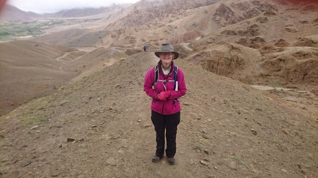
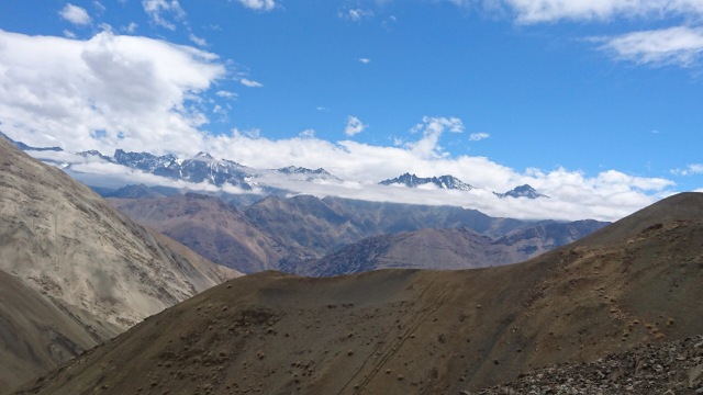
We woke up and walked to a 50 foot shining gold Buddha in the centre of the village and then proceeded to have the best day of the trek. Daddy was almost back out normal, the weather was clearing and we did climbed over two passes with relative ease. The first one was beautiful and the second outstanding – and our first real glimpse of snow capped mountains since Leh. We got slightly lost after the first pass, but were pleased that the steep slope we then had to climb seemed easier than it would have done a few days ago – we were acclimatising!
After the first pass, the path seemed to be heading to a dead end surrounded by tall mountains, and sure enough we had to climb up the mountain to escape. The path zig zagged up the crazy steep slope but we seemed to climb it reasonably fast and 3/4 of the way up we glimpsed our real prize, seeing the snow capped mountains. I had so much energy when we reached the top, surrounded by high mountains I walked up another small outcrop to get a better view, feeling awed and thankful that nature has provided us with such amazing things.
We had a hour and a half walk down to Ang, our final sleeping spot. Again, we just had the name of a guesthouse as a recommendation and spent a while honing in on it slowly climbing up Ang asking villagers as we went. Finally we asked a school boy and he not only took us to the place but went to fetch the owner from the fields to let us in and provide the welcome tea.
Day 4: Ang to Alchi Monastery to Leh
We were up early to catch the seven thirty bus back to Leh. We wanted to visit Alchi Monastery so our plan was to get off at the bridge on the Leh – Shrinigar road and walk the rest of the way to Alchi, about an hour and a half. The bus turned out to be an excellent idea. For most of the journey it wound around the nearby villages, including driving for 10 minutes down a dead end road and we got a wonderful slice of local life. The bus driver accepted tea and cake from one lady and stopped for 5 minutes to eat it, two ladies got on with three sewing machines and the conductor conducted business with half the people we passed, chatting and collecting money from them even if they didn’t get on the bus. Above all Ladakhi people on the bus were chatting, greeted everyone with ‘Julley!’ (which means hello, thank you and goodbye) and the bus general seemed to be the life blood of the surrounding villages.
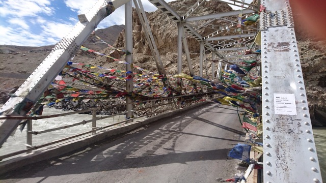
All got a bit more boring once we were on the main road, but soon we were dropped off at the bridge and crossed over from the Indian tectonic plate to the Eurasian one! First time for everything. Alchi Monastery was an impressive early example of Buddhism from Kashmir, Mummy got sick on the bus journey back and we ended the trek as we’d begun, one of my parents groaning in bed and in need of a good rest.

Pingback: Marka Valley Trek: we did it!!! Incredible rocks, mountains, animals and people – Travelling Inside and Out